Environment
Coastal location
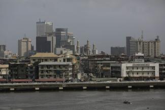
Lagos means “lakes” in Portuguese. What is now a megacity, was once a collection of settlements on the shores of – and islands in – the huge Lagos Lagoon, which is about 50 kilometres long. The city emerged where the lagoon meets the Atlantic Ocean. It has since expanded further north and further west into areas now known as the “mainland”.
Lagos Lagoon was a natural harbour, and sea-borne trade made the city important. For a long time, the lagoon was the main port in West Africa. By the mid-nineteenth century, the Àpápá port was built in addition. In 1997, a second port was finalised: Tin Can Island Port. Today, Lagos is the commercial centre of Nigeria. Its ports handle 80 % of Nigeria’s imports and 60 % of the exports.
In earlier times, Lagos’ many water bodies served as important transport routes. Today, however, bridges connect the islands to the mainland, and road traffic has become more important. Many small water bodies have been filled in and become urban land. There still is a vast system of creeks and canals, however, they are regularly used for dumping waste. A number of industries exist along former waterways, and many of them illegally discharge chemical waste. The megacity’s six drainage systems, moreover, drain into the Lagoon, causing pollution and adverse effects to the environment.
According to recent research, the water bodies in Lagos contain various pollutants, including metals, detergents as well as human and animal excreta. The dirty water contaminates the environment in general, affects the food chain and spreads diseases. The sad truth is that the historical affinity Lagos has to water does not translate into environmental awareness today.

