Remote management
KfW remote project management with KoBoToolbox
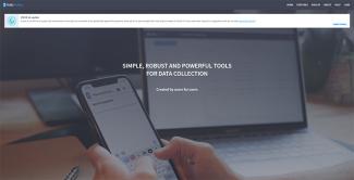
The tense security situation adds to the problems. Therefore, KfW uses a remote management information system called KoBoToolbox in Burkina Faso. It is an open-source programme that helps to digitally collect and manage a broad variety of data. Different kinds of information, including photographs, are entered into the programme.
In West Africa, KfW is also using Fieldbuzz, a similar programme which is not open source, but developed and tailored to the specific situation by a private-sector company. The collected imagery is geo-referenced and date- and time-stamped. It can be assigned to the specific location on a map. Fraudulent use of pictures from other construction sites is prevented.
Simply put, the entire process currently functions as follows: a consultant or local project manager takes pictures of the construction site with a commercially available smartphone. Then they write a report about the status of the project that conforms to fixed criteria and a predetermined structure and deposit both in the KoBoToolbox.
Next, the material is reviewed and then released by the project office in the country. From that point on, the responsible party at the KfW headquarters in Frankfurt can retrieve and review the information.
The staff members use a map of the country or project area, click on a marker for each site and call up the latest information. Thus, they can precisely determine whether a building has a roof yet or if a new street has become longer since the last inspection. If there are doubts or questions, it is discussed with the implementing entity what needs to be clarified or improved. Further progress must then be documented with new pictures and reports.
